
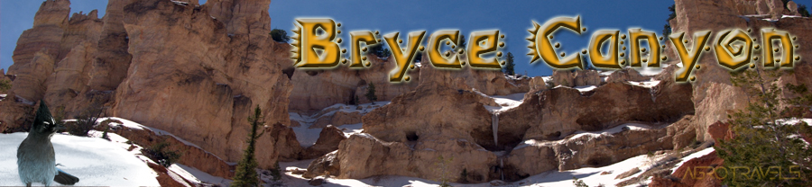
After leaving Grand Canyon National Park south rim, we initiated our second segment in our "Canyons Route". It took about 5 hours to reach Bryce Canyon National Park. We arrived after 6PM with just enough light to have an astonishing first impression of the canyon at Sunset Point.
Bryce is a much smaller canyon compared to Grand Canyon, but very different at the same time. Erosion inflicted by water, ice, wind, and hot temperatures gave shape to capricious landscape forming tunnels, natural bridges, and a geography of changing colors soil that gives you the impression of being in a different world.
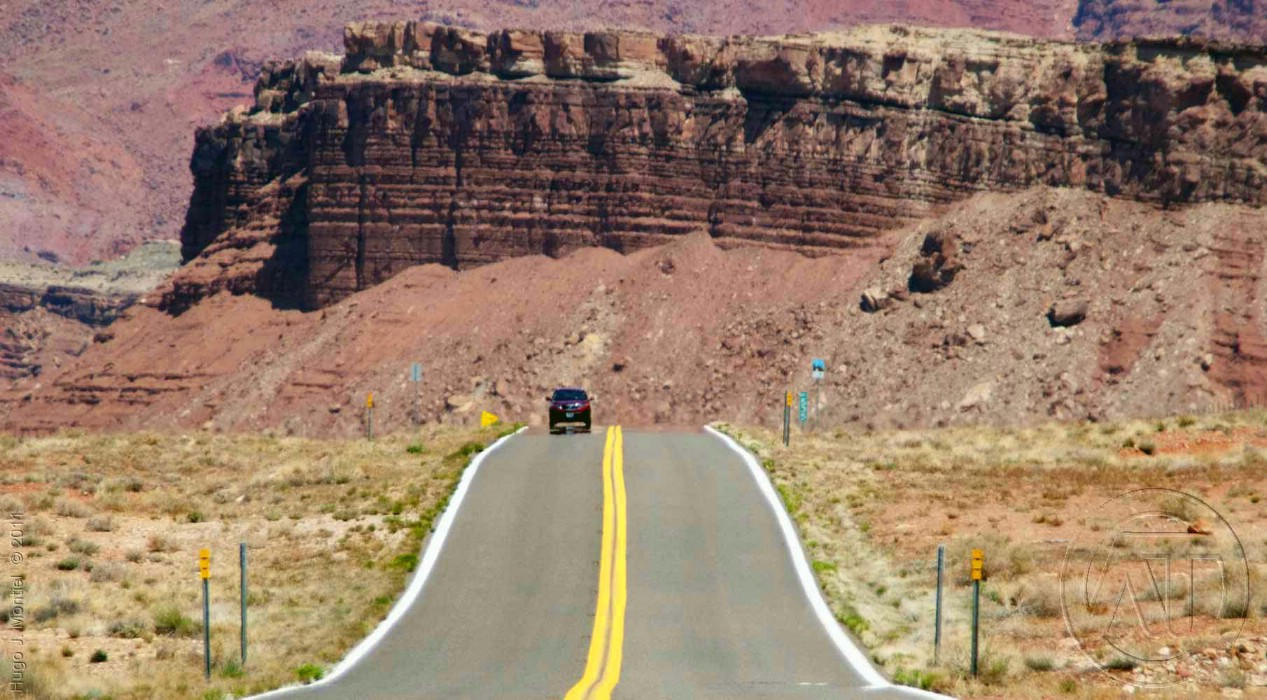
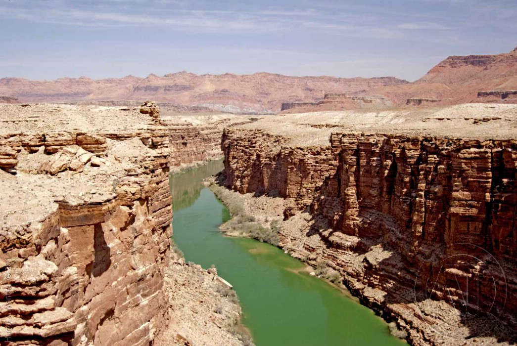
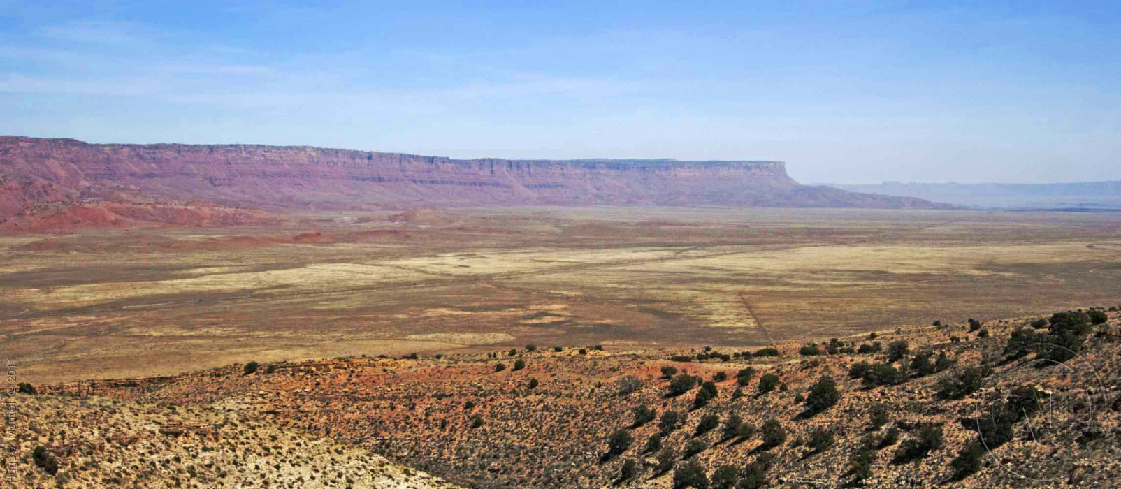
The road between the canyons is full of beautiful views of the vast desert with contrasting colors where time seems not to pass. Do not miss Marble Canyon at the bottom of the page!
On the first day we woke up at 4:00AM, we jumped out of bed, got a cup of coffee and drove towards Sunrise Point, which is one of the highest spots of the canyon. There you can enjoy sunrise and have a unique view with dazzling colors that only those making such effort of being there that early can see. It was surprising to find how so many people gather to watch the sunrise, most of them willing to capture images with their cameras, pros or amateurs alike.
First minutes of daylight are magical, shadows in the rock suggest faces, animals, and hundreds of other forms that your imagination may suggest.
As you walk down Queen's Garden trail, in a pleasant descent, you get immersed in this unique geography . At the bottom of the canyon, on the same trail, you will meet one of the two large creeks that crosses the Bryce Amphitheatre. Here the scenery changes once again, while looking up the rim it offers a total different view and impression. Tall trees, abundant vegetation, water, and lots of places with shade to take a rest from the long walk.
Our intent in this hike was to go through the Wall Street path, a less than 8ft narrow path between high rock walls resembling the tall skyscrapers in New York city. Unfortunately, we were not able to walk this part of the trail due to rocky landslides.
click on the image above to see the slideshow
In this trip we made a loop visiting four Canyons located near the border lines separating Nevada, Arizona, Utah. This chapter from Agrotravels covers the first stop in our route map at mark ![]() Bryce Canyon
Bryce Canyon
View Larger Map

After our disappointment with Wall Street being closed we returned to the junction of the Queen's Garden trail and the Peekaboo loop. We decided to split the group since some of us wanted to keep exploring the Peekaboo Loop. We then walked the upper side of the trail and that is where the real adventure started.
This is a little bit more than 3 miles trail that will take you a part of a less populated part of the canyon in its beautiful terrain. Although we did not complete the loop since we decided to take a deviation to the trailtaking us to Bryce Point.
Our change of plans of getting off the Pekaboo Loop was motivated by our assumption that the new trail would continue going up. I remember saying "we have come all this way up here, we can take the new trail and continue going up". Of course that would have been a great idea if our assumptions were true. But we learned that it would not be the case.
This new trail would go up and down at least four times before the final point was achieved. We can tell that this trail was not a low difficulty trail. On the contrary, the ranger would confirm later that it is the most aggressive trail of the the Bryce Canyon Amphitheatre.
On the most western segment of the Peekaboo loop, you will have the chance to see The Cathedral, the Wall of Windows and the Fairy Castle among other formations. At the trail junction we took the path up to Bryce Point, to complete our 4 ½ hours of trekking experience. Although, none of us regretted the decision afterwards, despite the effort.
The unique formations, arches, rocky totems, different color soil, the mix of red dirt with white snow and green vegetation are magically orchestrated by nature to offer you unmistakably views and an outworldly sensation that you will never forget.
Unforgettable Full Moon-Light Walk

They meet you around 9pm and you are not allowed to use any white flashlight to avoid your eyes being light-blinded. The purpose of not using any bright light helps your eye's pupils to dilate and get used to moon light. Once this happens you start to see with much more clarity than carrying a regular flashlight. Instead of a regular flashlight, carry a red led flashlight as it will give you the light you need while not affecting your pupils.
The experience is unique, walking down the trails as the Ranger gives you a great deal of information about the park, and its formation. They will lead the small group to a place where either they will pull out a telescope and focus on some stars and planets, or they will simply tell you a native story, either way they will add some magic touch to the scene.
We recommend to show up first hour in the morning to get your tickets as people line up before 8 am.
Visit National Park Services website. You will find lots of relevant information about all facilities and infrastructure services offered in this unique park.
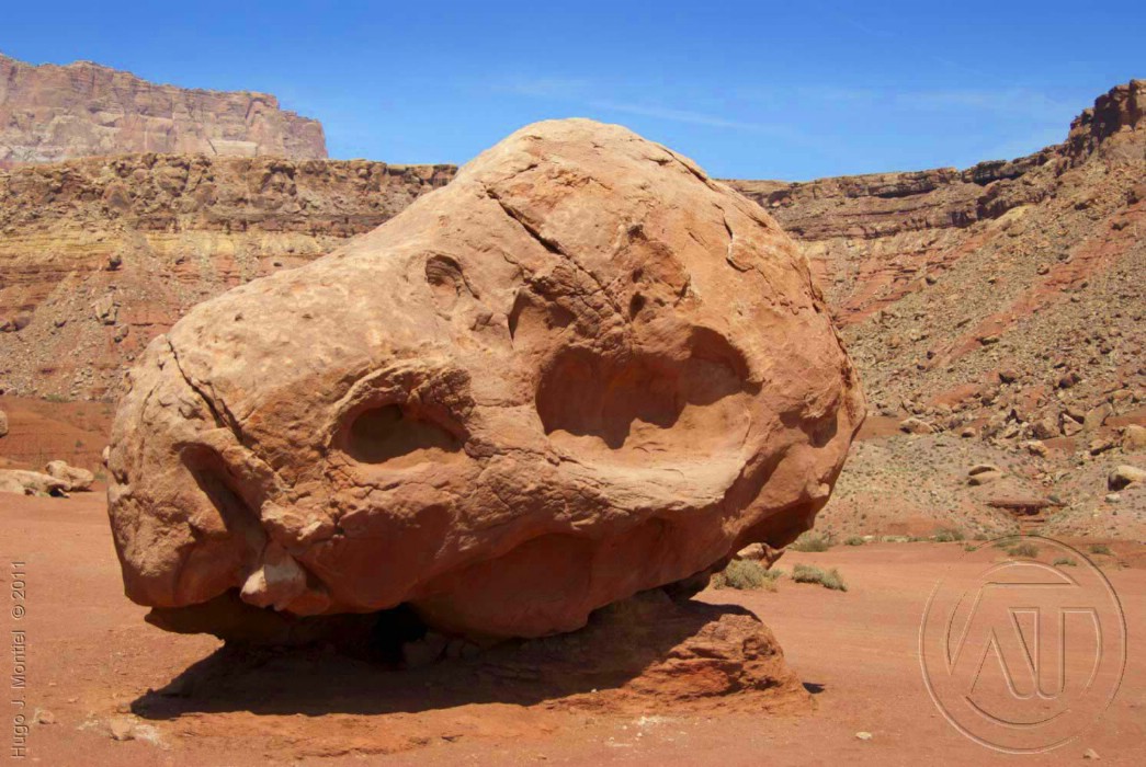
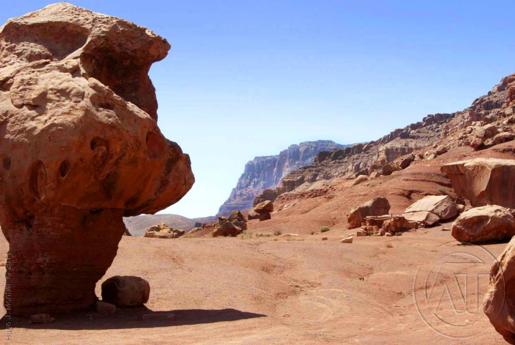
If you travel to or from Bryce Canyon on road AZ 89A, near Marble Canyon, there are interesting points and historical places.
Among them banjee-jumping bridges and a few miles after the bridge (going to Bryce) there is a place where the rocks look like marbles.
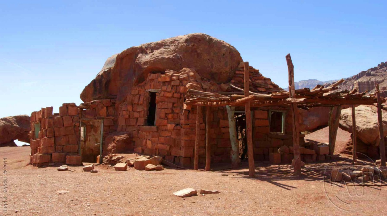
Even the historic home of a woman, who's car broke down in the early 20's and she built her home using a rock as supporting structure. This house is still standing.